FEMA Elevation Certificate In North Georgia
Lowery & Associates Residential Site Plans in Dalton, Calhoun and surrounding area.
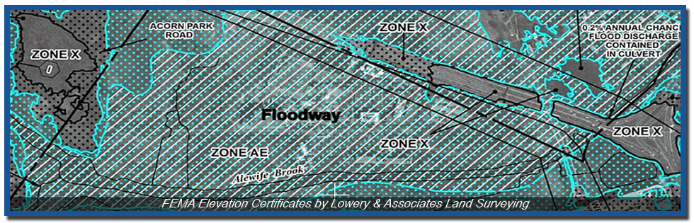
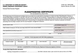
An elevation certificate is an insurance rating tool that's used to determine compliance with the National Flood Insurance Program (NFIP). The certificate is used to verify and document critical finished elevations of a structure to determine that structures eligibility for flood insurance. At times, a property may appear to be in a flood zone per the graphical representation on a FEMA flood map which could warrant flood insurance. In actuality, the structure may be above the elevation used to make the flood zone determination and an elevation certificate is used to prove this therefore rendering the need for flood insurance null.
Land Surveying Company serving the North Georgia Counties of:
Whitfield, Murray, Catoosa, Walker, Gordon and More.
Lowery & Associates Land Surveying Company registered in the states of:
Georgia, Alabama, Tennessee, Kentucky, Mississippi and North Carolina